
As land is a vital yet limited resource, sustainable management of urban land to catering the needs of the growing urban population is seen as one of the key challenges for achieving an economically efficient and environmentally safe society.
An effective approach for classifying urban land use is essential for meeting this challenge to improve efficient land use management. In particular, Deep Learning (DL), a data-driven technique, is able to extract non-assumption based features so that it can be explored to achieve superior performance of land use classification comparing to traditional machine learning methods.
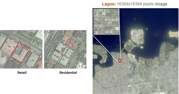
In this talk, we will introduce how DL is applied to assist in accurately identifying object classes with various geographic complexities by proposing the DL based classification system for urban land use. Along with the DL technology introduced, the relevant historical satellite imagery of two urban regions in Nigeria is parsed and analysed. Our findings may lead to further suggestions and recommendations for central and local government to design relevant policy in achieving the sustainable development of urban land use and planning.
Webinar was held on Wednesday 1st June.